
Contents


Story · Written by Kang Je-yoon Photographed by Studio Kenn
Connecting People and
Tranquility
Bridges connect the mainland and islands, making travel easier. In Jeollanam-do Province, the
connection of Geumodo and Ando islands via a bridge has allowed urban dwellers weary of city life to
discover the natural treasures of both islands and relax there. Kang Je-yoon, director of the Institute of
Island Research as well as a poet and photographer, explains how to properly explore these islands.
Jeollanam-do Province has 2,165 of the Korean Peninsula¡¯s estimated 4,000 islands, with the former¡¯s islands standing solemnly like guards in the sea surrounding the province. A mixture of small and large islands, the sea and mudflats provide a variety of food sources creating a unique regional cuisine and earning Jeollanam-do the nickname ¡°kingdom of flavor.¡±
The province¡¯s archipelago is partially protected by Dadohae National Marine Park. Nearly half of the islands are in Sinan-gun County, most of which have massive mudflats primarily used for farming since undergoing land reclamation. Thus the county¡¯s main source of income is agriculture, though octopus and seaweed fishing or fish farming are other occupations. Many islands are also included in the district of Yeosu and the counties of Jindo-gun and Wando-gun.
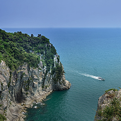
Yeosu has the second-most islands in the province. Situated on Jeollanam-do¡¯s southeastern side, these islands are relatively steep with fewer flat areas. Many of these islands over the years have lost their status as islands after bridges connected them to the mainland. Yet the famous tourist islands of Geumodo and Ando remain islands though both are connected to each other by a bridge. By ferry, it takes only 25 minutes from Singihang Port on Dolsando Island—connected to Yeosu by bridge—to Geumodo. Despite its proximity to Yeosu, the islands are still remote, and their separation from the mainland seems to affect how time passes on the islands. No wonder both islands attract weary urban dwellers seeking comfort.
Walking Along Cliffs
Geumodo covers 26.99 square km stretched along a 64.5-km shore. Its mountains and valleys are believed to have provided a habitat for tigers until the 1920s. In the Joseon Dynasty era (1392-1910), the island was off-limits to people since hwangjangmok (yellow-hearted pine) trees, whose wood was used to make the royal crown, grew there; Geumodo also had a national deer ranch. This ban lasted for 400 years and kept the island¡¯s nature pristine. In 1885, the rule was lifted and people started to live on the island again, and today, Geumodo has 1,500 residents.
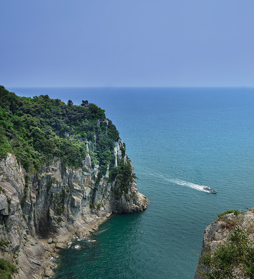
Dense evergreen trees earned the island the nickname ¡°Geomuseom,¡± meaning ¡°it looks black.¡± Cheonggudo (Map of the Green Hills) and Daedongyeojido (Territorial Map of the Great East), considered the largest and most detailed map produced during the Joseon era, marked this region ¡°Geomado,¡± which was later renamed ¡°Geumodo.¡± The cliffs are how people discovered this island. An old slope where people used to pass by to collect timber and seafood had not been used for 400 years, and after the island¡¯s opening, the slope was restored into a cliff trail. The 18.5-km trail going from Hamgumi Dock to Jangji Village offers a breathtaking view of the ocean and comprise five sections connected as one road.
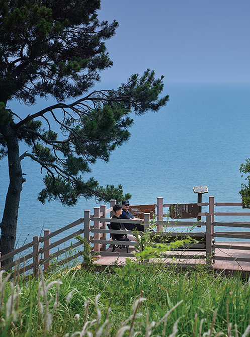 The trail along the cliff has a bench and an observatory.
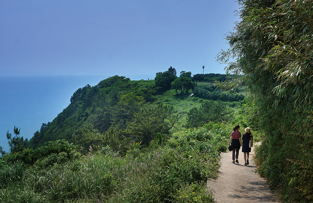 The cliff trail on Geumodo Island boasts a scenic view of the dense forest and the vast blue sea.
Every angle along the trail offers a spectacular view, the best being at the first tourist spot called ¡°seaweed room,¡± named after the drying of seaweed by locals on a flat rock on the cliff large enough to accommodate a few dozen people. From this spot, visitors can clearly see Narodo Island in Goheung-gun County, where Naro Space Center is located.
The cliffs also feature a unique style of graves. In the past, an island tradition was for the family of the deceased to make a temporary grave and eventually move it to a permanent place. Vines form natural tunnels at the third and fourth tourist spots during summer while red camellias create a picturesque scene during winter. This section of the trail alone attracts more than 300,000 visitors per year.
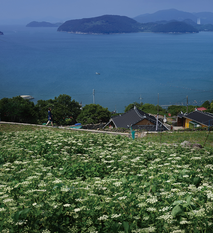
With white flowers in full bloom, siler roots, a medicinal plant of the Umbellifer family, welcome visitors who travel by sea to Geumodo Island.
Homey Comfort
The fifth tourist spot is Jangji Village, where Ando Bridge connects the islands of Geumodo and Ando. While Geumodo feels grand and magnificent with its open view, Ando is more of a place for feeling at home and winding down at the end of the day. This homey vibe is what gave the island the first part of its name ¡°An¡± (comfortable). The narrow entrance from the seaside leads to a wider trail as visitors get closer to the village, bringing to mind an image of a reservoir trapping the seawater. The waves also roll in an ¡°S¡± shape here.
Seawater trapped in the village is invisible from outside of the island, giving rise to a legend that Ando offered pirates a perfect strategic base a long time ago. The nearby Sorido Island also has a similar pirate story, and its location also made it the country¡¯s fishery hub during Japanese colonial rule (1910-45). Despite its small size of 3.96 km2, Ando used to be a leading stopover in international sea trade from ancient times.
The round pebbles all over Yiyapo Beach on the village¡¯s west side make the spot a great place to quietly sit and appreciate the water. Dangsan Mountain in the middle of the village houses a folk religion temple with more than a millennium of history, making the mountain sacred. Though rituals are no longer held here, the mountain remains full of holy energy.
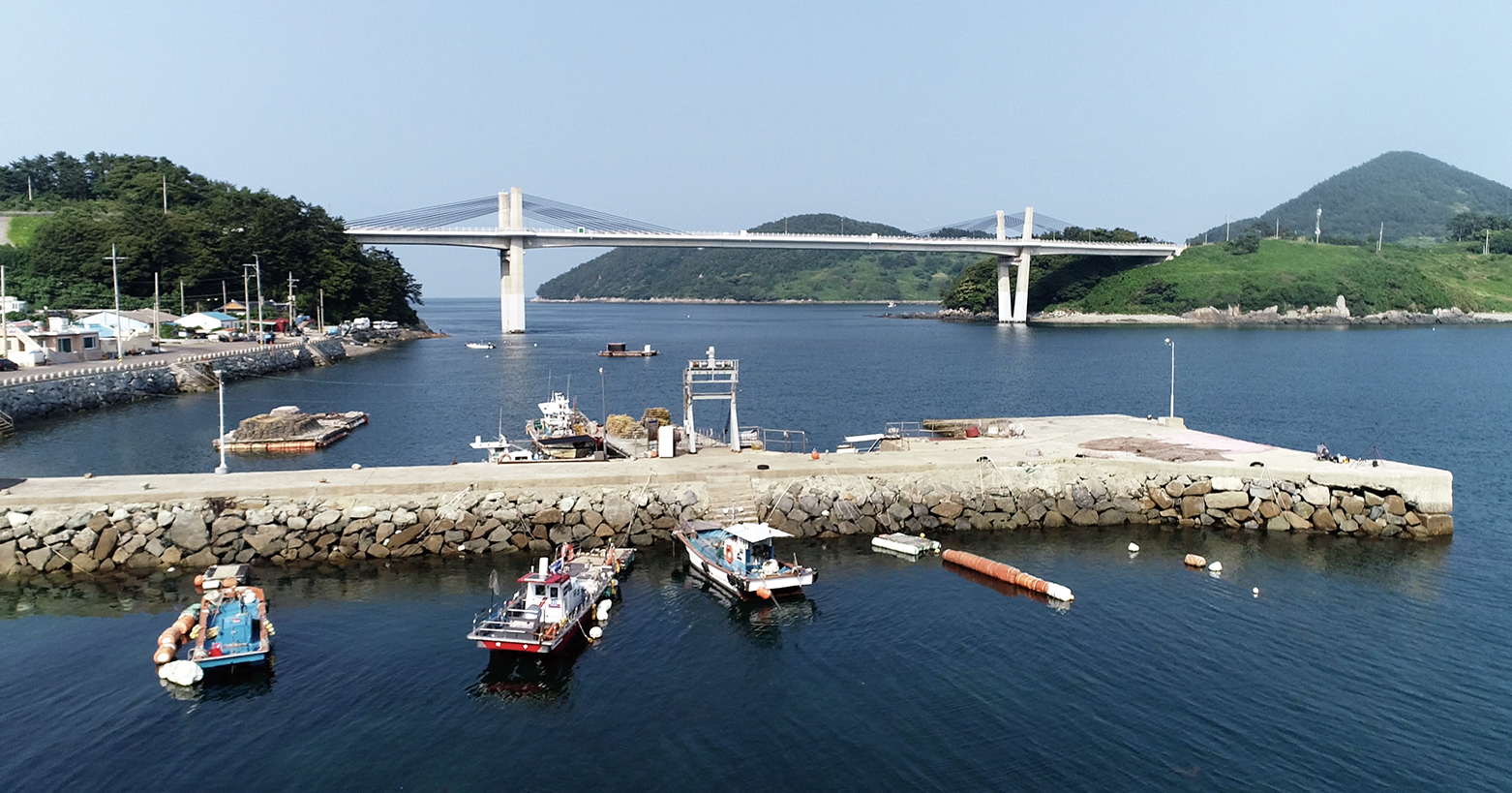
Geumodo and Ando islands are connected by Ando Bridge. © Shin Jung Sic
Maintained by the Sea
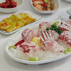
As of 2019, Ando had four haenyeo (female diver), down from 18 during the 1990s. Ando haenyeo are mostly those from the area rather than from Jeju-do Island, which is far more famous for such divers. The waters around Ando have long been famous for biodiversity and fresh seafood. Mussel, a food whose quality is hit or miss in other regions, is always consistently delicious here and full of meat. Conch caught here is also rich in scent and flavor.
A Korean tradition is for a woman¡¯s family in the provinces to cook their son-in-law (her husband) chicken, but on this island, a variety of seafood is served to special guests mainly comprising barnacles and seaweed obtainable only by haenyeo. The culinary experience here featuring such seafood can hold its own against anything on the mainland. Another facet of this tradition is labor sharing, as villagers help catch and prepare seafood when a party is held.
Geumodo and Ando islands are perfect for taking a leisurely stroll, with nobody pushed to hurry on long slow walks. Cars are prohibited on the trail. The slower the pace of walking, the more one can appreciate and explore the beauty of the islands. The same landscape can lead to the creation of paintings with varying themes and interpretations based on the pace of observation and individual perception and experience. A careful and slow walk often has visitors seeing things that are easily missed while riding in a vehicle. Thus the recommendation is to enjoy and experience these two islands at the slowest pace possible.
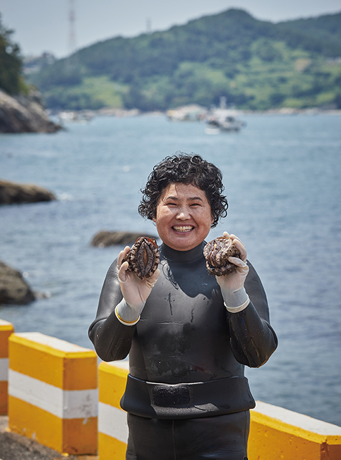 A haenyeo (female diver) smiles while holding up a fresh catch. The number of such divers has dwindled to just a few on Geumodo and Ando islands.
 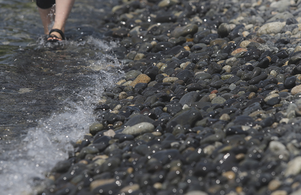 Round pebbles, rendered smooth over a long time, sparkle on the beach.
More about Jeollanam-do Province ⟶


Other Articles


