April 2021
April 2021
Not only is Jirisan Mountain KoreaˇŻs most iconic wonders of nature; it is also the first National Park to receive the designation. Spanning across a sizable portion of the Korean peninsula (from Hamyang-gun, Sancheong-gun and Hadong-gun counties of Gyeongsangnam-do Province to Gurye-gun County, and Namwon-si City in Jeollabuk-do Province) is Jirisan Mountain. Join us as we cover the start to and the endpoint of the Jirisan Dulle-gil trail in the rural town of Unbong-eup, Jucheon-myeon, Namwon.
![]()
Written by
Seong Hyekyeong
Photographed by
Studio Kenn
Any nature enthusiast who loves KoreaˇŻs rugged slopes will find Jirisan special in many ways. As the mountainˇŻs scale spans over several provinces, this article will only cover the Jeollabuk-do Province portion, near the city of Namwon.
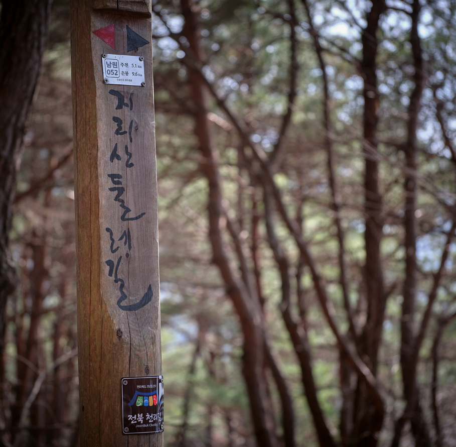 The wooden signpost signals the scope and
directions of Jirisan Dulle-gil.
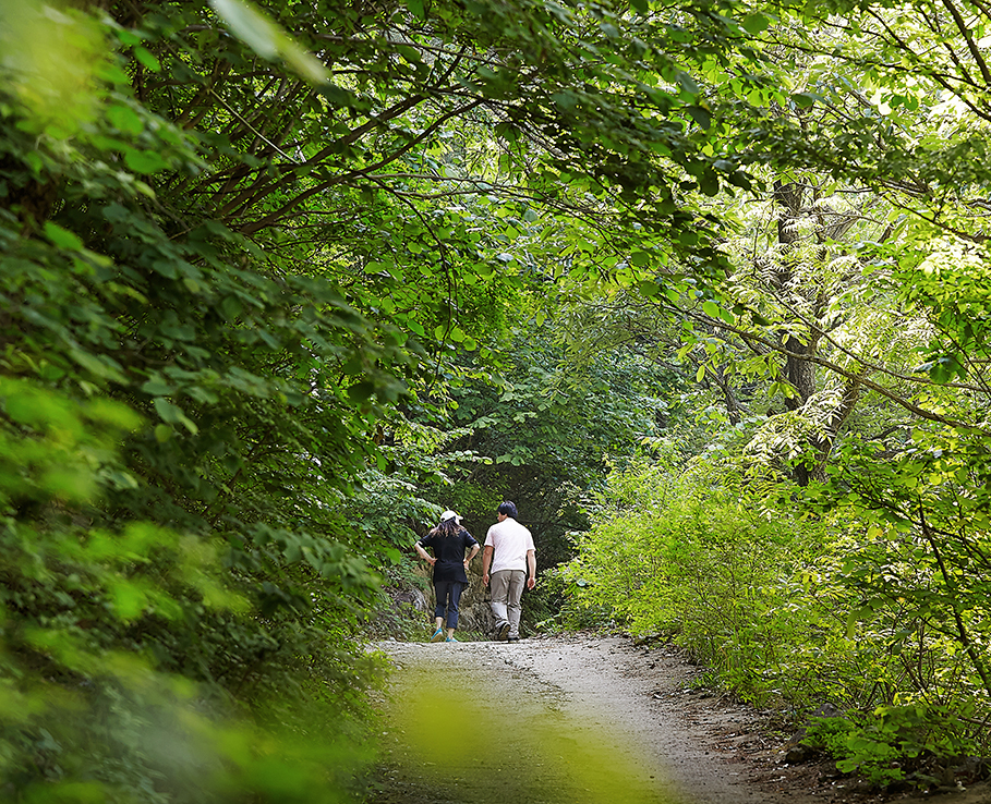
The rural town of Namwon is where the iconic Jirisan Dulle-gil Trail begins and ends. The famed trail, frequented by those seeking a tranquil, leisurely trekking session rather than one of extreme physical exertion, begins at Haengjeong Village in Unbong-eup, Jucheon-myeon, Namwon.
The village is situated on the northwestern part of the entire Dulle-gil course, on the Unbong plateau: an intersectional point between the rural mountainside and the modern tourist facilities.
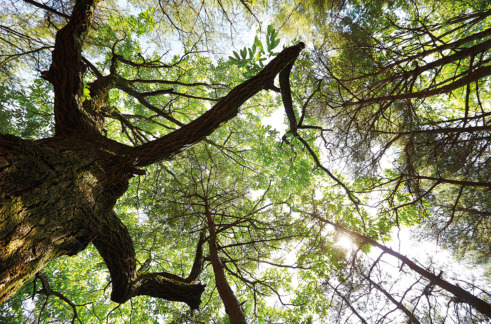
Haengjeong Village greets you with a colony of pine trees. Besides their typical rugged shape, also noticeable are scars of uniform shape glaringly piercing the lower midsection — or at eye level — of their barks. They are not natural marks but are literal scars from the colonial era during which pine trees were stripped of their resin, or sap and utilized as oil for aviation fuel.
A more light-hearted representation that configure pine trees quite literally is their tendency to pursue sunlight. Many of them, at least the ones in this region of the country, are curvy. This shape is a natural result of their inclination to chase wherever is better lit by the sun.
Whether the pine trees in the Unbong plateau, which leads gradually up the trekking course of Jirisan Dulle-gil, or standing amid the forests of Jirisan look the way they do because of the pain they have weathered or due to their natural tendencies, it is clear that pine trees embody honest reflections of the years theyˇŻve endured.
 Curvy trees were deemed worthless, until they formed colonies on mountainsides and formed a reliable buttress guarding the slopes.
Their curvatures are an emblem of
pine treesˇŻ natural inclination toward the rays
and warmth of sunlight.
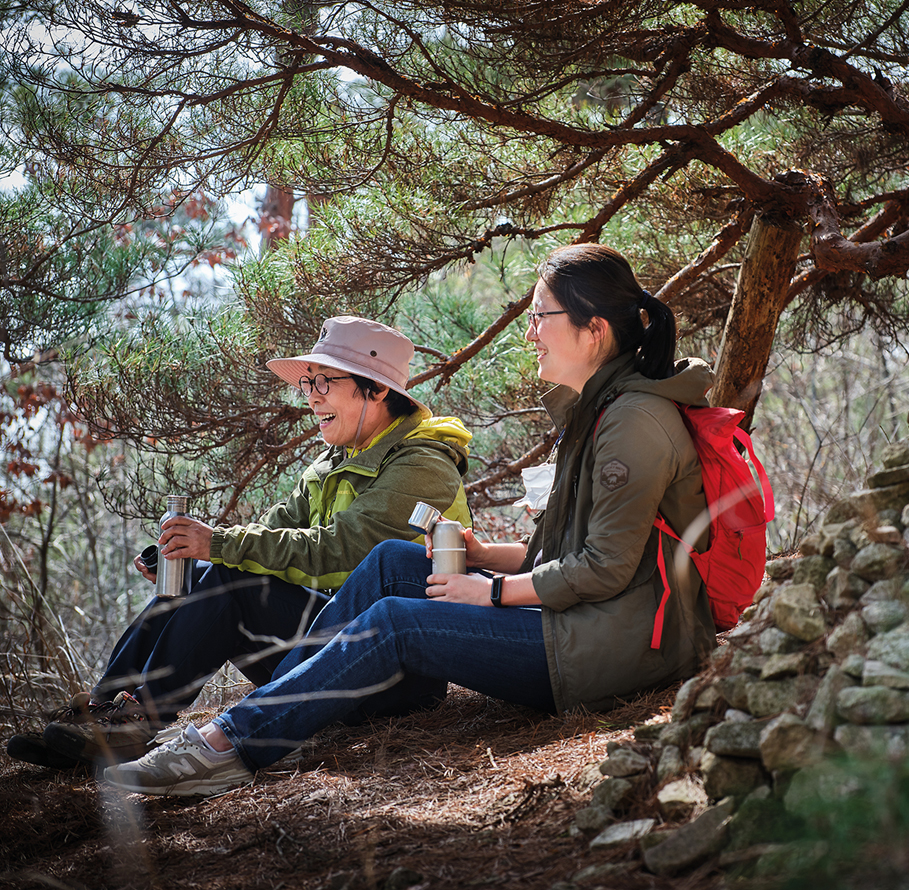
It is difficult to know how Haengjeong Maeul Village retains serenity considering how well known the Dulle-gil is, though elderly villagers are prone to greet visitors with open arms, especially youths — a demographic rural villages like these often lack.
Streams cutting through the village have modern hanging racks and steps, yet such facilities are designed for washing and hanging clothes — itself a manual, less modern act. Our friendly local guide points out, ˇ°This particular facet is a manifestation of that boundary between modernity and antiquated [customs and lifestyles].ˇ± While modernity can be glimpsed through tourist-welcoming placards and signposts filled with explanations of the trees, tractors pass by to reap harvests and the air often carries wafts of manure.
Nestled in the heart of the area is Guryong Valley, also known as Yonghogugok (ˇ°Dragon Lake Valleyˇ±), colloquially dubbed the latter for its accompanying legend. As folktale has it, the valley is visited by nine dragons descending from the skies every first day of the fourth lunar month. Characteristically, the closer to the lower base-level where the water streams lace themselves against rocks horizontally, the cooler the air feels. No wonder it is a prime spot to enjoy natural summer springs.
The valley is about 4 km-long and flanked by trails constructed for easy trekking. Feeling the cool breeze of the rock-steeped valley, one can feel why the area is most frequented by visitors in the months of May and October, when buds have blossomed but temperatures are mild.
 Clad in casual hiking gear, comrades bond over
the fulfillment reaped from climbing steep trails.
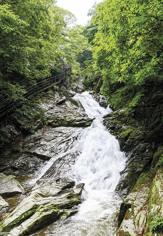 Guryong Waterfall uniquely consists of clearer waters at
the bottom than on its upper cliff. © Namwon city
From the region where we commenced our journey — the starting point of Dullegil — a roughly paved road is a glaring remnant from the past. Previously having linked Unbong-hyeon and Namwon-bu (as they were previously classified), the road imparts a poignantly antiquated atmosphere.
Hiking upwards on a small hilltop of the Hogyeong region just a five minutesˇŻ drive away, pine trees become even more predominant. Pointing to their figures, our guide reminds us of how straight-standing pine trees are the prime choice for anything to do with woodwork, especially for building cabins and most traditional housing. Those that havenˇŻt been chosen now fill the mountaintops, flanking the hillside as if to protect the habitat rather than merely populate it.
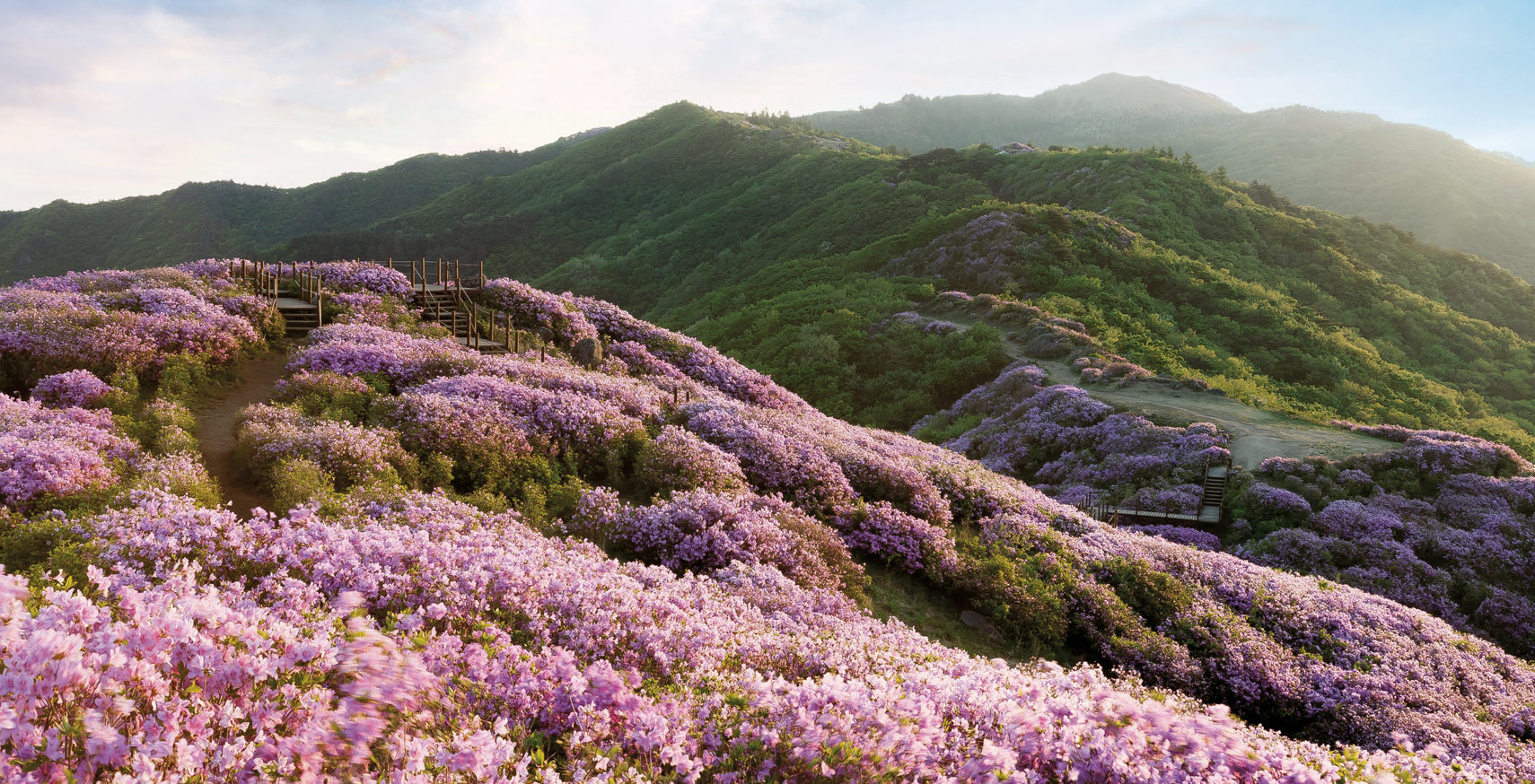
JirisanˇŻs standout flowers blossom fully in April, heralding a colorful preview of what luscious vistas are set to unfold in the following month. In this part of the Jirisan Mountains dubbed ˇ°Hogyeong,ˇ± an expression to denote ˇ®a village with a fine view,ˇŻ the alder tree claims a pivotal role in its ecosystem. True to its name, the mountainous habitation flaunts royal azaleas, which have sticky surfaces to trap insects and small-flower forget-me-nots. Thus Jirisan lives up to its stature as a series of flower-studded valleys.
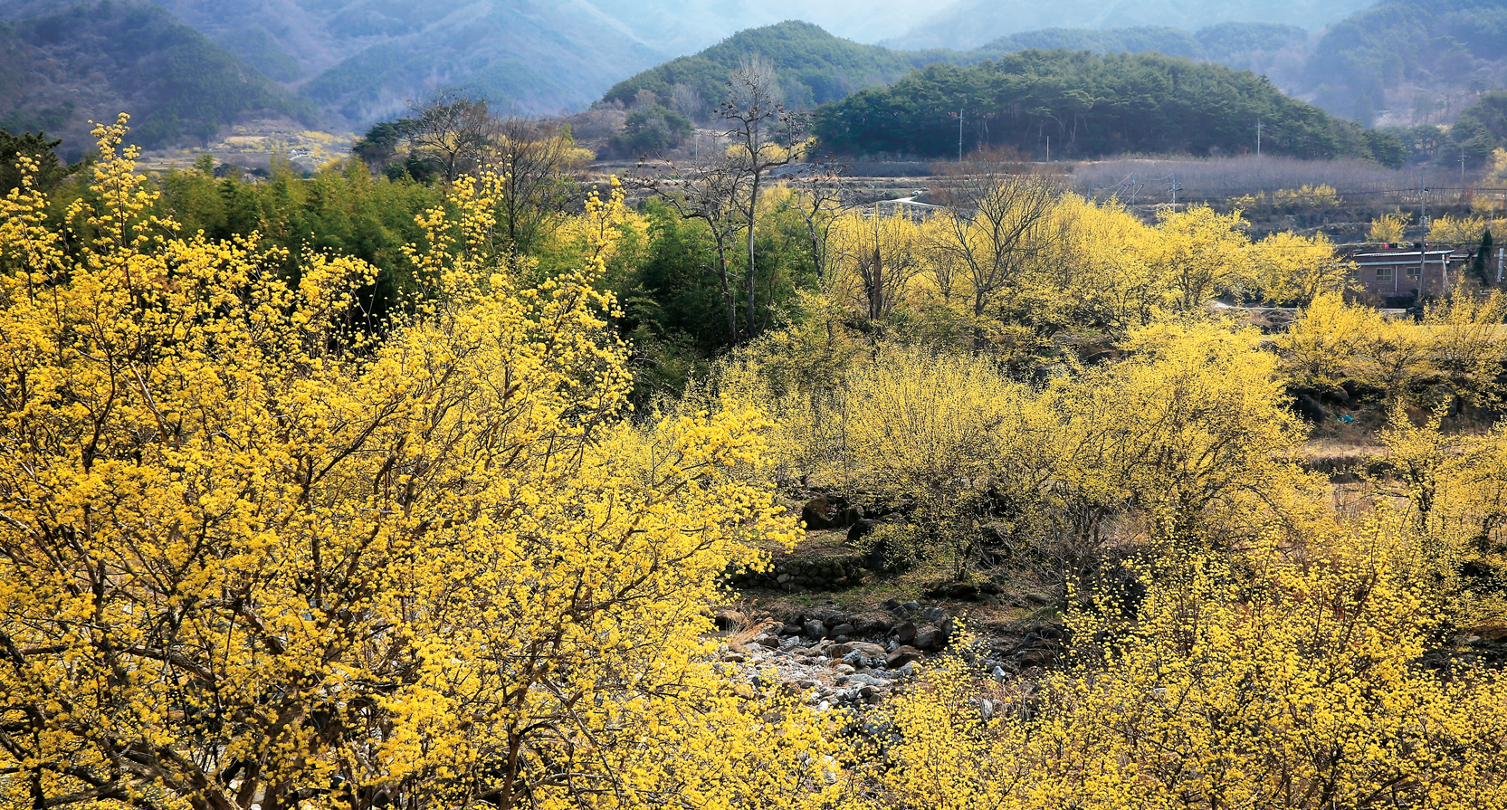 The southern part of Jirisan National Park is Gurye-gun, a county especially renowned for its sansuyu (yellow -flowered trees). © clipartkorea


